Can drones be used for laser scanning?
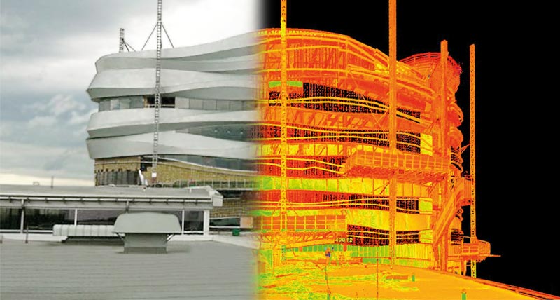
Aerial imagery is nothing new, but the construction, manufacturing, and industrial industries don’t benefit from photos that are static, maybe 10 years old or older, and don’t capture data. Using a combination of state-of-the-art drone and 3D laser scanning technology, however, companies can capture a current look at the actual site, the lay of the land, buildings, and other structures, and collect an immense amount of data. At Hive Virtual Plant, we provide our clients with high-end state-of-the-art 3D laser scanning technology by Leica Geosystems. Along with the use of 3D laser scanning technology, the use of drones can also be beneficial with data collection. In this article by Hive Virtual Plant, we share some information about the use of drones for ariel 3D scanning.
Click here to learn more about our services at Hive Virtual Plant.
Common terminology that goes along with ariel drone imagery
If you are not familiar with drones and drone technology, then there are a few terms that you should know, especially if you are looking to utilize ariel drone imagery for your company. Some common terminology includes:
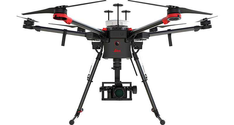
Drones:
An unmanned aerial vehicle (UAV), commonly called a drone, is a component of an unmanned aircraft system (UAS), which includes a UAV, a ground-based controller, and a system of communications between the two.
Photogrammetry:
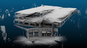
This is a rendering process that stitches together photographs captured by the drone cameras to create a continuous map or 3D model along with all associated data.
Data Points:
The X, Y, and Z coordinates of any point in space based on a fixed reference location. These coordinates are the essential elements of every map or scan.
Can drones be used in unison with 3D laser scanning?
The uses of 3D scanners and drones are endless, especially when used together. But the best part of using these technologies is the benefit to our clients. These include:
Saves time:
An area that used to take days or weeks to manually map with a GPS or a traditional survey can now be flown and mapped in hours or a few days, depending on the size of the project. Less time spent surveying at a worksite translates to cost savings for clients, and helps speed up the entire construction timeline.
Increased data and accuracy:
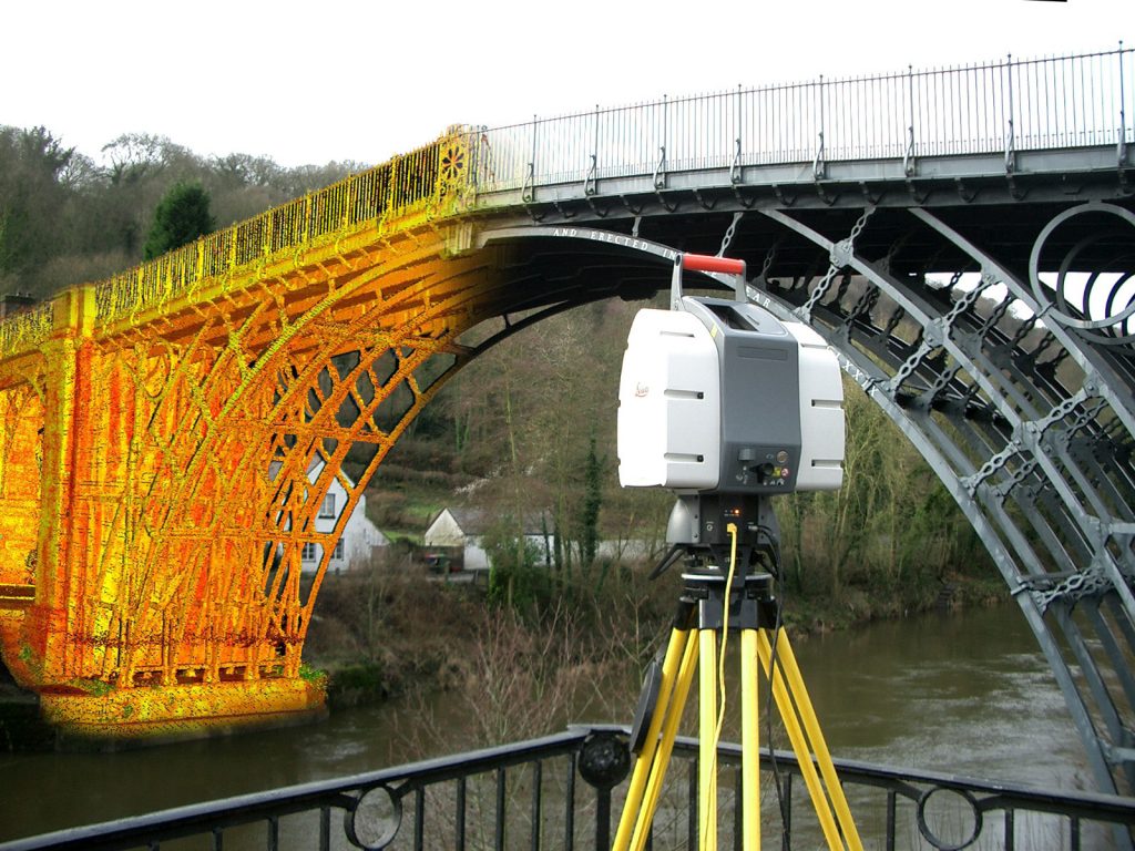
Using 3D laser scanning technology along with drone technology can provide the most accurate data collection possible. Additionally, once you have a point cloud of your site or interior space, you can reference that information forever.
If you are looking for more information about if drones can be used for laser scanning or 3D laser scanning technology, then we encourage you to get in touch with a Hive Virtual Plant representative today.
Click here to find or contact information or to speak with a Hive VP representative.

About The Author: Rob Jickling
More posts by Rob Jickling