Benefits of 3D Laser Scanning for Land Surveying
At Hive Virtual Plant, we take great pride in the high-end 3D laser scanning services and equipment we supply our clients. 3D laser scanning can be used in numerous applications that range from calculating overhead clearances to surveying land for a build. If you are wanting to learn more about some of the benefits of 3D laser scanning for land surveying, then you have found the right company: Hive Virtual Plant. Along with the state-of-the-art 3D laser scanning services that we provide to our clients, we are also in the business of providing plenty of information about the industry as a whole. Continue reading this article to learn more about some of the benefits of 3D laser scanning for land surveying.
Click here to learn more about our services at Hive Virtual Plant.
3D scanning for land surveying cuts field time and provides faster results
In the past, field surveys would take days or even weeks to complete. Now, by using laser scanning technology, it’s possible for Hive Virtual Plant to complete the same field surveys in just one single day. Laser scanning also enables us to complete fly-throughs, 3D models, detailed animations, and maintenance materials in less time than ever before.
3D laser scanning for land surveying helps to cut project costs
The increased speed and accuracy of laser scanning means that our survey team has to complete fewer field visits to collect data. This reduces the overall cost of a project for you.
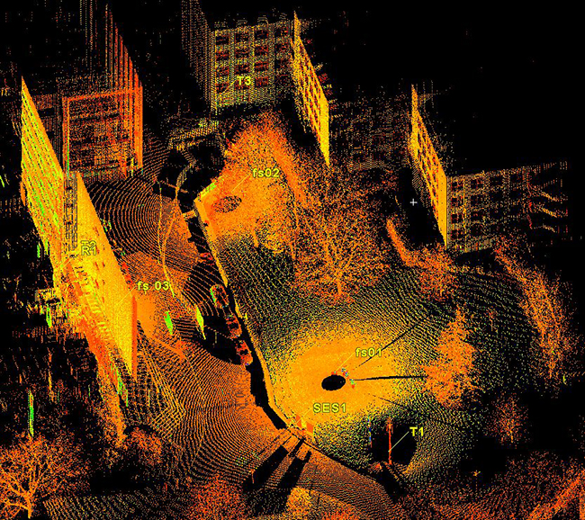
3D laser scanning provided accurate data for land surveying
When you are trying to survey a piece of land, especially a large plot, it is essential that accurate data is collected. Laser scanning technology produces the most accurate data available. This solid knowledge base helps the project manager plan better projects.
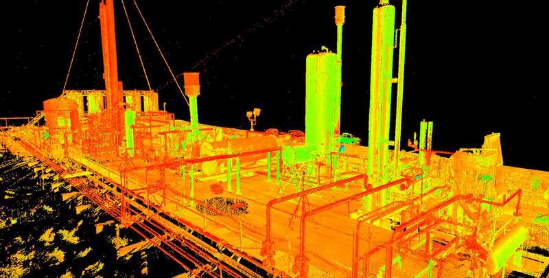
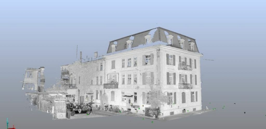
3D laser scanning can be a versatile tool for land surveying
3D laser scanning technology can be used for many different aspects of land surveying. Some of these aspects include budgetary and timeline preparation, application implementation, historical preservation, reaching once-impossible areas, change detection, hazard surveying, and accident reconstruction. 3D laser scanning technology can also be used for producing detailed topological maps, volumetric calculations, 2D drawings, 3D models, and more.
The above mentioned are just a few of the benefits of 3D laser scanning for land surveying. If you are looking for more information about 3D laser scanning technology, we encourage you to get in touch with a Hive Virtual Plant representative.
Click here to find our contact information or speak with a representative at Hive Virtual Plant!

About The Author: Rob Jickling
More posts by Rob Jickling